2019 saw a considerable increase in the use of drones for commercial purposes, ranging from aerial capture for marketing purposes to mission critical inspections, and that momentum is only expected to continue.
One specific industry seeing a rapid uptick in the use of drone technology is the real estate appraisal industry. This is in part due to the reduced risk of putting workers in potentially hazardous or hard to reach locations, the ability to capture a perspective of a property that simply could not be taken from the ground, and the ability to share property data without ever needing to step foot on the property.
We’ve recently partnered with realquantum to empower appraisers further and allow them to supplement their current solutions with drone imagery and video. Read on to learn more about the multiple aspects of a property drones can help capture.
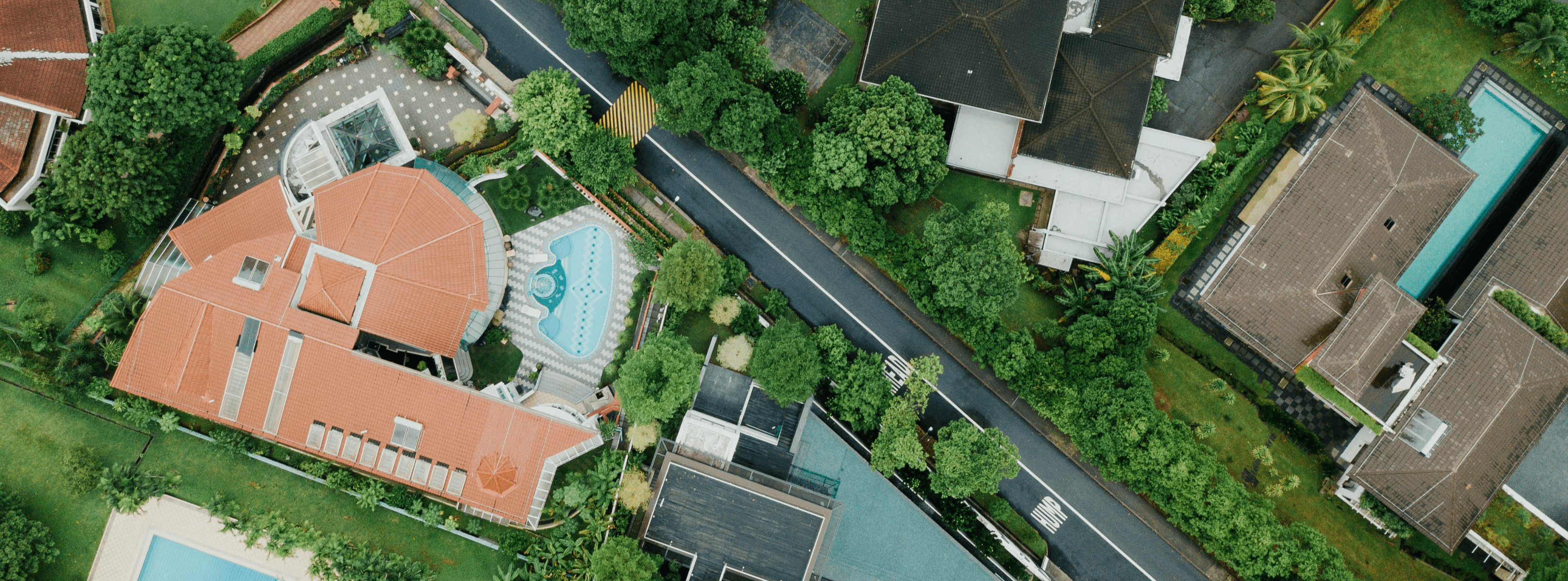
Roof & Facades
Roofs can be difficult to access and awkward to navigate. As a result, ground teams are hindered by safety concerns and, in some cases, a need for extra equipment. Using a drone means you can gather information from every angle in a fraction of the time, and without the need for roof access.
The information gathered from high resolution drone imagery can then be used to generate an in-depth property condition report that considers more than 70 roof conditions, including debris, overhanging vegetation, water ponding, and more. DroneBase Insights roof reports provide a detailed summary of issues and their severity so appraisers can share that information with their clients and allow them to make informed decisions.
Parking Lots
Capturing true parking lot conditions is a balance of both high and low altitude imagery. High altitude imagery can provide a full view of the parking lot and gives a glimpse at the overall condition. For example, appraisers can easily spot trouble areas where vegetation is overgrowing or count the number of parking spaces within the lot.
Low altitude imagery provides a more in-depth look at anomalies or potential damage. Cracks in pavement can be tough to spot but with the ability to zoom in and out of high resolution imagery with minor distortion, appraisers can spot those issues quickly and act accordingly.
Access Roads
A vital component to any property valuation is understanding the property’s accessibility. In most cases, this includes the entrances and exits to the property, as well as surrounding roadways like a highway or busy roadway that may drive more traffic to around the location. But locating all access roads within a property can be challenging, especially for large properties, with standard methods. An issue that often arises is satellite imagery can be outdated or too low resolution to be used.
An aerial perspective of a property captured via drone allows you to better locate these roadways and identify potential issues or obstructions. Our 60,000+ professional pilots are distributed throughout the country, are located near most critical assets, and can often complete a flight within 48 - 72 hours, weather permitting.
Surrounding Area
Drone imagery provides a unique perspective that captures a contextual view of the property and its surroundings. Picture yourself standing in front of a single story stand-alone building, from the ground you are primarily able to see the storefront and parking lot. Now picture yourself a few hundred feet in the air, you can still clearly see the building but now you’re also able to better visualize the area and identify surrounding points of interest.
As we progress through 2020 we believe that drone technology and its solutions will continue to be increasingly adopted by enterprises in a multitude of industries, including the real estate appraisal industry.
Interested in learning more about the realquantum and DroneBase partnership? Visit Commercial Appraisal Aerial Photography Options written by realquantum CEO Jeff Weiner.

.png?width=360&name=What%20Aerial%20Inspections%20Actually%20Reveal%20About%20Roof%20Health%20(2).png)
.png?width=360&name=Banner%20Templates%20(4).png)