.jpg)
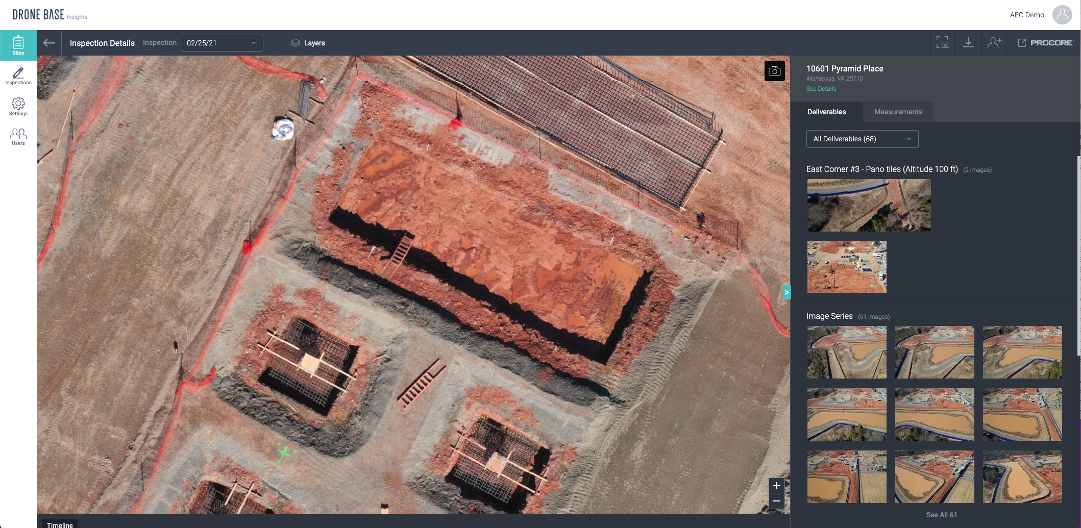
In construction, visibility into projects is just as important as visibility into financials - it is business intelligence. Maintaining visibility is critical to completing projects on time and under budget. The use of drones and aerial imagery are making this easier and changing the way key stakeholders plan, measure, track and build. Aerial imagery has many applications across engineering, architecture, and VDC teams but this added visibility serves more than just these roles. Here are some other key stakeholders benefiting from enhanced project visibility.
1. Owners and Investors
Building owners and financial investors must have a clear understanding of development progress, a key in protecting capital investments that are directly tied to a timeline and budget. With multiple projects spanning entire regions, countries, or continents, gaining this visibility remotely creates huge efficiencies. With the AEC Insights platform, these key stakeholders can navigate through projects with visibility from every angle. Making it possible to easily share project information virtually or use the imagery to conduct meetings with visual communications.
2. General Contractors and Project Management Teams
General Contractors, and their Project Management teams on-site, are key to executing any project effectively. General contractor roles are often required to maintain visibility across entire regions and potentially hundreds of projects at any given time. For project managers, communicating timelines, allocating resources, coordinating materials deliveries, and submitting change orders, RFIs and other key project updates are essential. Aerial imagery, coupled with the AEC Insights platform creates a single-source solution to streamline construction progress monitoring. The aerial data enables GCs and Project Management teams to minimize rework and enhance site management in every phase of a project, helping these key roles deliver projects on time and under budget.
.gif?width=663&name=exportforgif_AdobeCreativeCloudExpress%20(1).gif)
3. Executive and Administrative Teams
Executive, financial, and administrative teams can also reap the benefits of enhanced visibility. Many executive teams use the project imagery to communicate project milestones, or as marketing material to show the great work being produced. Accounts Payable and Procurement teams make use of this imagery even after closeout helping resolve problems related to material billing, sub-contractor payout, and new hire training and onboarding.
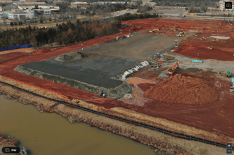
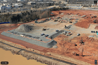
(Two weeks of site progress)
Aerial imagery isn’t just a solution for engineers and VDC teams, it’s a valuable business intelligence tool that is most effective when shared across project teams and key stakeholders. This is why the AEC Insights Platform was built with the whole organization in mind, creating visibility into every phase of construction, from groundbreak to completion and beyond. DroneBase is building tools to make acquiring project visibility easier than ever. We’ve organized the world's largest professional drone pilot network, pushing over 80,000 operators and counting. Coupled with our easy-to-use insights platform and integrations with best-in-class partners like Procore, making meaningful business decisions with enhanced visibility is easier than ever.
The DroneBase AEC, Mapping, and LiDAR team will be at GEO Week ‘22 click here to schedule a meeting time.
More about our AEC solutions here.

.png?width=360&name=What%20Aerial%20Inspections%20Actually%20Reveal%20About%20Roof%20Health%20(2).png)
.png?width=360&name=Banner%20Templates%20(4).png)