The Residential Real Estate business is fast-paced and competitive. Millions of properties change hands across the U.S every year and an increasing number of home buyers are finding the property of their dreams through the internet.
All of which means it’s more important than ever for listings to stand out from the crowd. There are a number of ways you can do this, from sparkling aerial imagery to in-depth reports that give buyers greater context when it comes to deciding which properties to pursue.
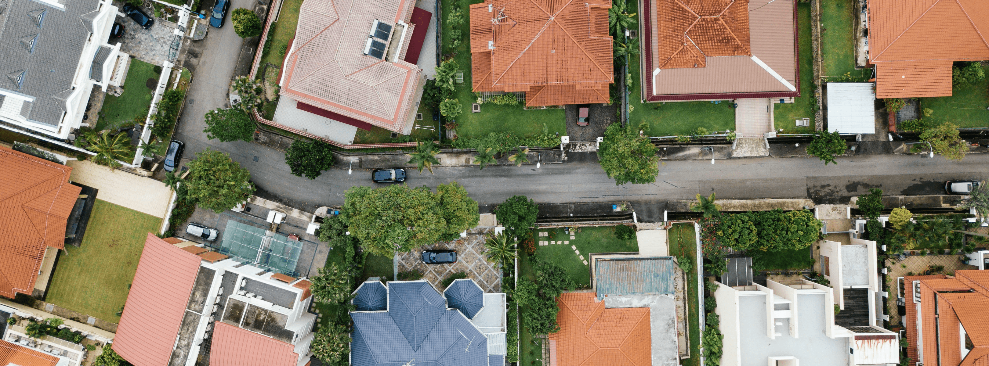
At the foundation of these innovative new listings is a technology we’re very familiar with: drones.
Read on to discover how these advanced tools are changing the face of residential real estate and how agents, brokers, and real estate companies can benefit from adopting drone technology.
Enhanced Listings
First and foremost, drones offer an affordable means of differentiating your property from the rest. You can now get incredible aerial image and video packages for a fraction of what they would historically cost. Drones are portable, and the technology is ever advancing which also means that missions can be completed quickly, ensuring you have those high-resolution images and videos in time to build a compelling listing.
Additionally, the return on investment of unique aerial imagery can be dramatic. More professional and informative listings generate greater interest, help you stand out from the competition, and ultimately lead to properties being turned around faster.
These benefits come back to a simple fact: aerial imagery enhances property listings in a multitude of ways. It provides a literal overview, frames a property within its context, and allows you to highlight special features in a way that you can’t do from the ground. Additionally, in a post-pandemic world where viewings are more complicated than before, aerial imagery compliments traditional property media safely.
Ultimately, using drones to improve your residential property listings leads to better-informed potential buyers and less time wasted in multiple stages of the process. Aerial overviews can be as informative as they are appealing, cementing a potential buyer’s intentions without the need to visit a property.
Property Assessments
Professional aerial imagery isn’t the only way to enhance a residential property listing. Drones can also be used to assess a property’s condition and build a full structural report ahead of a sale going through.
These reports give potential buyers a better understanding of a property, its condition, and its dimensions. They also give property management agencies a thorough idea of how to plan ongoing maintenance.
-
-
The Insights Roof Report, which offers an assessment of a home’s structural condition and in-depth analysis.
-
-
-
The Thermal Insights Roof Report, which helps detect issues that otherwise can’t be spotted, such as moisture entrapment under a roof membrane.
-
-
-
The Insights Measurements Report, which provides accurate measurements and dimensions to help plan maintenance and construction projects.
-
Just as with aerial media, the data can be gathered in a short amount of time and at a relatively low cost compared with manual methods. Better informed buyers can make important decisions with greater confidence, so whether you’re encouraging sellers to list with you or putting properties on the market, drone data will add value to your proposition.
Taking Property Listings to the Next Level with DroneBase
There are numerous ways that drones can be used to supplement your residential property listings. The first is with aerial media, which can include high-quality video clips, high-resolution photographs, edited marketing videos, or packages that combine all of the above. You can take a look at our full suite Residential Real Estate packages here.
Another way to supplement your residential or commercial listings is with DroneBase Insights Roof Reports. Allow your potential buyers to make better-informed decisions about the condition and/or dimensions of the property through one of our Insights Roof Condition, Insights Roof Measurements, or Thermal Roof Condition reports.
Whether you're a property owner looking to sell or a prospective buyer looking for your next property, aerial images, video, and data from drones could be the differentiator that helps close your next deal.


.jpg?width=360&name=Banner%20Templates%20(12).jpg)
.jpg?width=360&name=Banner%20Templates%20(7).jpg)