There are few industries in business today that do not yet employ drones. Real Estate, Insurance, and Property Management are just a few of the many industries that have changed their ways of operating by incorporating drones into their workflows.
Another large industry learning the many use cases for drone data in their daily operations is the Construction industry. In this article, we expand on how to effectively use a drone in construction planning, the types of deliverables that can be produced from drone data, and the biggest advantages for companies still considering the use of a drone in construction.
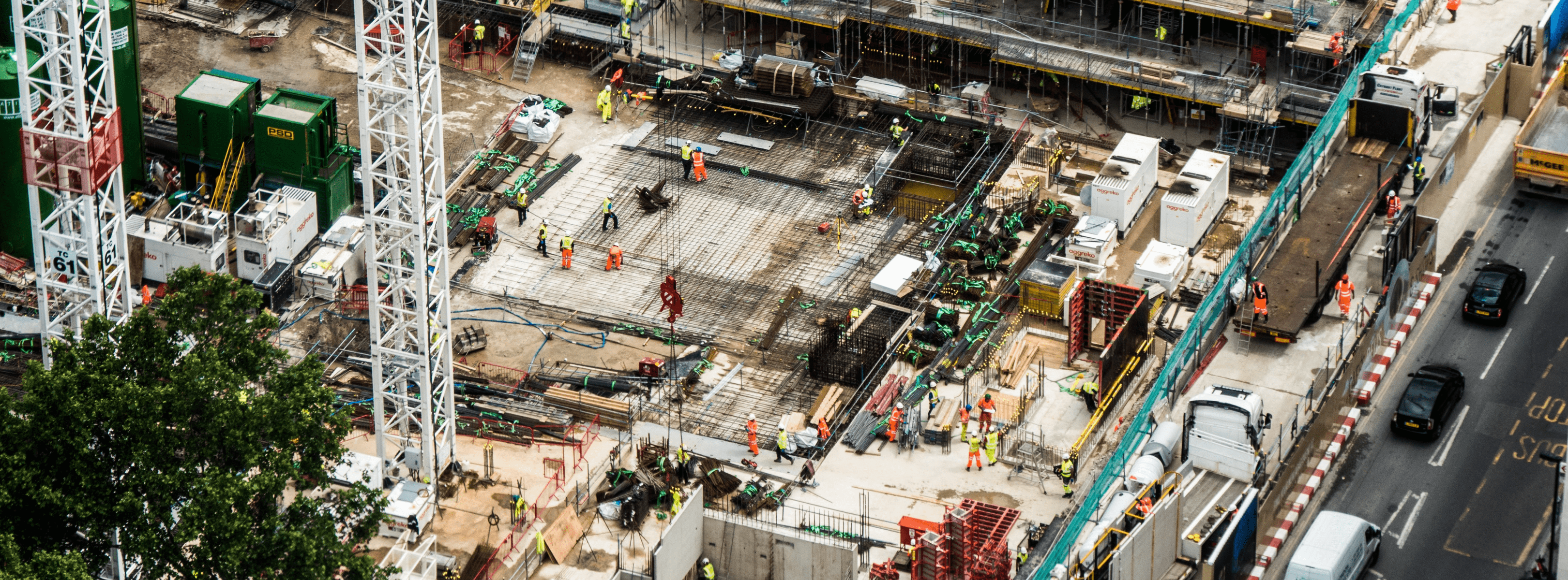
Keeping Track Safely
Remember a time, not long ago, when getting an update on a project involved sending yourself or a colleague into an area with inherent hazards, or required spending a significant amount of time getting to that area? With the use of drones, aerial photography can help projects stay on track with accurate progress reporting without the need for sending teams into potentially hazardous situations. This in turn allows construction stakeholders to track, map, survey, inspect, and ultimately manage worksite projects better.
Getting Another Visual
In addition to standard progress images and video, DroneBase has the ability to produce orthomosaic maps and three-dimensional (3D) models. Aside from visualizing the site with images and video, data collected by the drone can be compiled into highly detailed and geometrically accurate 2D or 3D models. One example of a DroneBase customer using this technology today is Stockpile Reports. Stockpile Reports is an inventory management system using the power of drone imagery to measure cement, ready-mixed concrete, landscape materials, mining, etc. Since partnering with DroneBase, Stockpile Reports has benefitted from a 98% decrease in time spent on site and a 400%+ cost reduction.
Smarter Inspections and Project Management
The ability to create a 2D (orthomosaic) or 3D model from drone imagery is possible, but requires a level of consistency that may be difficult to achieve when flying manually. This is a big reason why drone manufacturers like DJI have made it easier to achieve the level of accuracy needed in the Construction industry by building out autonomous fly modes. DJI’s Ground Station Pro (GS Pro) allows pilots to create or adjust flight paths, change flight parameters such as image overlap or altitude, and focus on flight planning. Using the data captured from the drone, DroneBase is then able to produce an orthomosaic or 3D model that can be used to analyze multiple aspects of the site.
Scalability
Through drone use in construction, key stakeholders can gather the necessary data needed in order to maintain project progress, without the need for boots on the ground. This in turn reduces time on-site, certain safety concerns can be mitigated, and the ability to scale operations across multiple worksites becomes much more simplified. Another aspect, not referenced as often, is the data that comes from drones is easily digestible for both team members and potentially customers. Often in the format of a jpg (image) or MP4/MOV. (video), these file types can easily be shared amongst team members or imported into an existing solution or platform.
Scaling operations across multiple work sites is often challenging and is a big reason why a drone service provider such as DroneBase can be advantageous for those in the Construction industry. The DroneBase pilot network has given multiple operations the ability to scale drone operations with licensed, vetted, and trained pilots in all 50 U.S states. The drone operators within the DroneBase network, alongside our experienced Operations team, take care of pre-planning, safety checks, asset management, and quality control. Taking a step beyond just the data, DroneBase is partnered with leading analytics companies to easily integrate into existing workflows.
Flexibility
Whether you are seeking a package of high-resolution photos, high-definition images and video, an orthomosaic, or a 3D model, DroneBase can provide you with the deliverable that best fits the need. Our network of trained pilots are often able to fly the property within 48 - 72 hours of the flight request, but if pre scheduling or calling a point of contact in advance to coordinate is required, that is also an option.
In short: it’s time to consider the benefits of drones. With such promising time savings, reductions in cost, along with the increased safety, the return on investment for using drones in construction seems like a no brainer.


.jpg?width=360&name=Banner%20Templates%20(7).jpg)